Non ci sono articoli nel tuo carrello.
Tags: Supply Chain, Logistics, Geocoding, Transportation, GPS API
Hi! I’m Samir — a Supply Chain Engineer and Data Scientist based in Paris, and founder of LogiGreen Consulting.
I help companies improve their logistics operations using data, AI, and automation to reduce costs and minimize environmental footprint.
Let’s use n8n to analyze geographical data!
📬 For business inquiries, you can add find me on LinkedIn
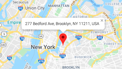
This workflow is designed for logistics and transport teams but also market analytics experts that need to process geocoding data (get GPS coordinates from addresses).
Ideal for:
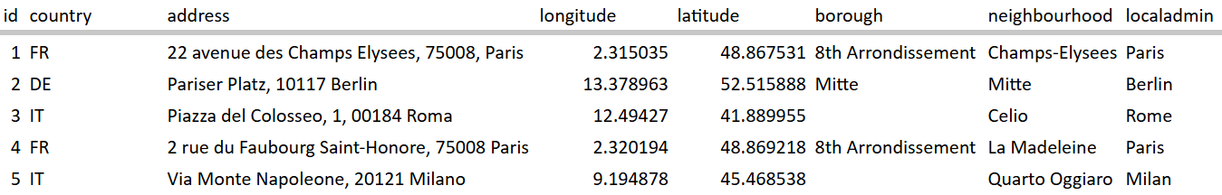
This n8n workflow connects to a Google Sheet where you store addresses with country codes, and uses the OpenRouteService API to calculate:
This workflow is beginner-friendly and requires:
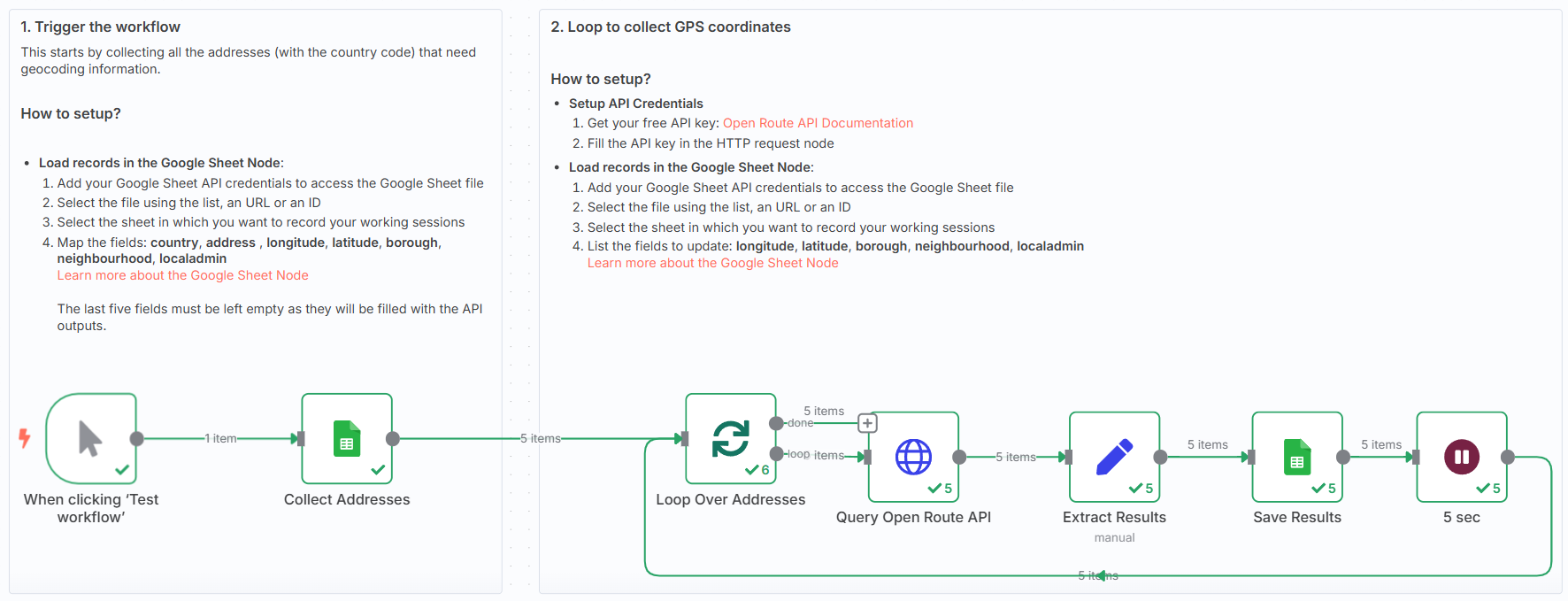
🗒️ Follow the sticky notes inside the workflow to:
🚀 You can customise the workflow to:
This template was built using n8n v1.93.0
Submitted: June 1, 2025